Why do flight times vary so much?
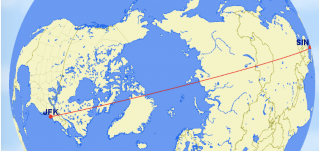
As far as possible flights are planned as “great circle tracks”. A great circle track is the shortest distance between two points.
A great circle track may not always look like the shortest way on an “ordinary map”. The traditional map used for non-aviation purposes is the Mercator projection.

The issue with the Mercator projection is that it becomes highly inaccurate towards each of the poles.

Notice here the difference in size of for example Greenland.
So a huge part of your wonders may come down to the traditional (Mercator) perception of our world.
Let us illustrate this with an example. A flight from New York to Singapore.
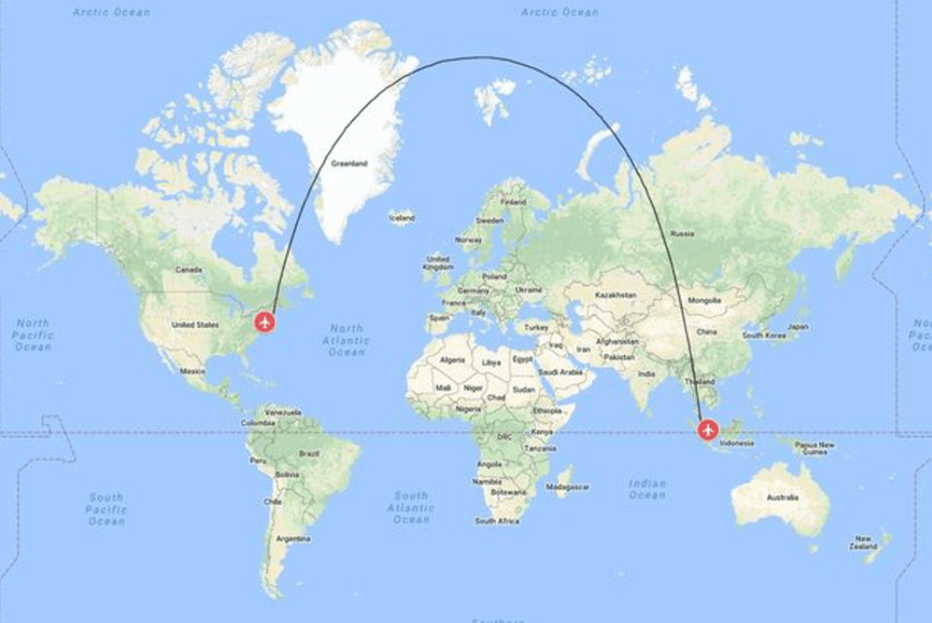 On a Mercator map, this looks like a major detour.
When the truth is that it is as direct as it gets.
The impact of the wind
An important factor for flight times is wind. At the altitude that most airplanes cruise, it is not uncommon to have around 150- 200 mph head- or tail-wind. The strong winds are called jet streams. These jet streams are in some parts of the world pretty constant. An example is flying from Europe to the US.
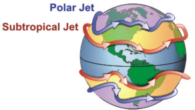
As you can see there is both the polar jet and subtropical jet that flow from West to East. In most cases, unless you can find a route that goes between the two jets, you will have a headwind going from Europe to the US. And going from the US to Europe, most likely you will have a tailwind. The difference in flight time due to headwind and tailwind can easily be more than 1 hr but of course, it will depend on factors on the day. On a flight to and from Australia of course the wind may have an even bigger impact.
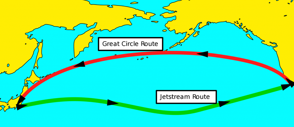
Example of routes taking advantage of the jetstreams.
Overflight of countries
Flying over countries will require permission. A lot of the time there are charges for flying into a country flight information region (FIR). It is possible for airlines to speculate in as few crossings of FIR regions as possible. This could be to limit the FIR charge. Think of it like trying to avoid the highway road tax and be going via a country lane instead.
Unfortunately, sometimes FIR crossings may be problematic due to political or safety concerns. So it is not always down to trying to safe on the charges.
In range of alternates
Lastly, there is a planning aspect of being in range of a suitable airport. Airplane engines are highly reliable, but still, there are rules that must be followed. These are referred to as ETOPS. Extended Range Twin Operations approval. To keep it simple the ETOPS approval will allow an aircraft to fly for example 180 minutes away from a suitable airport. This would be referred to as ETOPS 180.
Here is an example of what ETOPS planning could look like.
As you can imagine, there are some routes that can be difficult to plan in regards to having a suitable alternate. If you cannot have a suitable alternate, for example flying to Easter Island, the airline will need to follow additional procedures in order to be compliant.
Weather systems
Weather can be another factor influencing flight routes but it is typically something that would be looked at in connection with each flight departure. However, it can not be out-ruled that there are some areas that are haunted by particularly bad weather. In these cases it is possible that an airline, in general, will avoid having routes that way.
Conclusion – why do flight times vary so much?
The short answer which will probably be correct most of the time is = because of the wind (jetstreams).
However, there might be a little more to it than just the wind.
Looking at a typical map (Mercator), flight routes are likely not to be represented correctly in terms of “directness”. Flight routes could look like curved paths, when in fact they are direct lines (great circles).
Lastly FIR charges, weather, and suitable alternates may also have an impact on flight times.
We hope that you enjoyed the details. If you have any questions please feel free to ask via
our question form. From time to time, we publish questions and answers, if we think they are in the interest of others.
Happy landings
Ask A Pilot